


Participating in training and oil spill exercises is a great way for NOAA’s Office of Response and Restoration (OR&R) to maintain and improve our spill response and natural resource damage assessment (NRDA) capabilities. That’s why we’re constantly seeking opportunities to collaborate with our federal, state, and industry partners to advance our application of science and technology, improve our capacity to respond, and strengthen our partnerships.
In May, OR&R went to Covington, Louisiana to participate in Chevron’s 2018 Emergency Response Training. During the week-long drill, OR&R’s Emergency Response Division provided scientific and data management support to the U.S. Coast Guard, and OR&R’s Assessment and Restoration Division led the coordination with Chevron and the Louisiana Natural Resource Trustees to identify and prioritize resources at risk, identify local expertise and subject matter experts, develop conceptual site models, and prioritize data collection efforts (ephemeral data).
The drill simulated Chevron’s worst-case scenario discharge at their offshore drilling operations — the Mississippi Canyon 122 (MC 122) facility located roughly 50 miles from the Louisiana shoreline. In the drill, as would be the real life worst-case scenario, the discharge was an estimated 465,709 barrels of oil per day.
“This is an alarming amount of oil, with a high potential to result in ecosystem level impacts in the Gulf of Mexico, much like the Deepwater Horizon oil spill that occurred in 2010,” said Liza Hernandez, an environmental scientist with OR&R’s Assessment and Restoration Division. “By continuously working to improve our response and NRDA capabilities, we can position ourselves to more rapidly and effectively cleanup the spill, and better determine the environmental impacts so that we can fully restore the environment to it’s pre-spill conditions.”
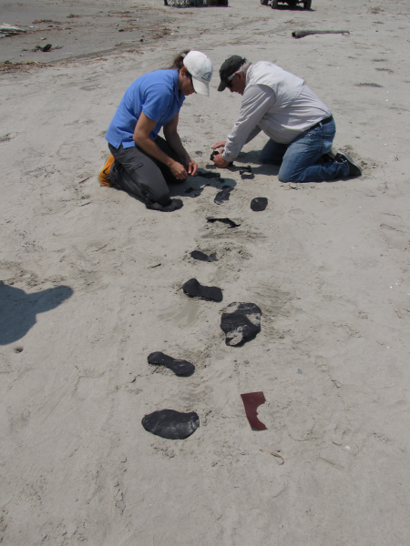
Over the last four years, NOAA has been working closely with Chevron, as well as other industry, state, and federal partners, to advance our ability to use drones, also known as unmanned aircraft systems, to inform response and NRDA efforts during an incident. Several applications of using drones and collection of remote sensing data have been tested for several purposes including detecting offshore oil on water, conducting reconnaissance and shoreline oiling assessment, and identification of impacted wildlife.
We have tested a number of sensors and platforms that provide both still imagery and full motion video in several different formats including natural color, near-infrared, and a combination of wavelengths or spectrums that allow for estimating oil thickness. One test that was conducted was of a sensor package that collects natural color and infrared imagery and uses an algorithm to combine wavelengths and approximate the thickness of oil on water.
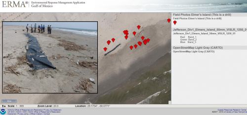
For this particular training and drill exercise, one primary objective of incorporating drones was to collect and provide imagery of simulated oil and wildlife in near real-time back to the incident command post to inform response and NRDA operations during the drill. To accomplish this we tested various platforms and sensors. Chevron and their contractors were able to successfully collect high resolution imagery and relay it into the NOAA common operational picture (COP), Environmental Response Management Application (ERMA), as well as Chevron’s COP in near real-time (approximately 15 minutes).
To gather recreational use data, daily aerial overflights have been utilized in previous spills, which can be effective, but costly. A potentially more cost-effective alternative for such surveys may include the use of an aerostat to collect video or imagery that inform changes to recreational use in areas resulting from an oil spill. An aerostat is a tethered stationary balloon with a camera that can be placed in close proximity to a recreational area, such as a beach, a fishing pier, or a boat ramp.
As part of this training and drill exercise, the NOAA team also worked with Chevron to test the aerostat’s utility to inform NRDA recreational use surveys at Fontainebleau State Park. Our hope for future assessments is to employ this tool as a viable and more economical platform for conducting NRDA recreational use surveys.
“Ensuring we are prepared to respond to an oil spill incident by participating in these types of exercises will ultimately provide increased benefits to the natural resources we strive to protect and restore,” Hernandez said.
. Image credit: NOAA.")

