Every month, NOAA’s Office of Response and Restoration’s (OR&R) Emergency Response Division provides scientific expertise and services to the U.S. Coast Guard (USCG), ranging from producing oil spill trajectories that estimate where a spill may spread; to identifying possible effects on wildlife and fisheries; to estimating how long oil may stay in the environment. We also receive requests to track and model other floating objects, such as log booms or shipping containers that have broken free, whale carcasses, fish die-offs, and algal blooms.
During April, OR&R provided response support for 18 incidents, including six new incidents in three states. The six new incidents were all actual or potential oil spills.
OR&R staff prepared 46 incident reports and documents, including three fate and trajectory analyses. Most of the incidents this month were unknown volumes, but two of the incidents had volume estimates. Cumulatively, these incidents posed an approximate risk of more than 13,000 gallons of oil.
(Note: All spill volumes are approximate and based on initial information that may be updated after further investigation.)
Below, learn about an incident we were working on this month:
Pipeline Leak, West Cameron Lease Block 564; Offshore Louisiana
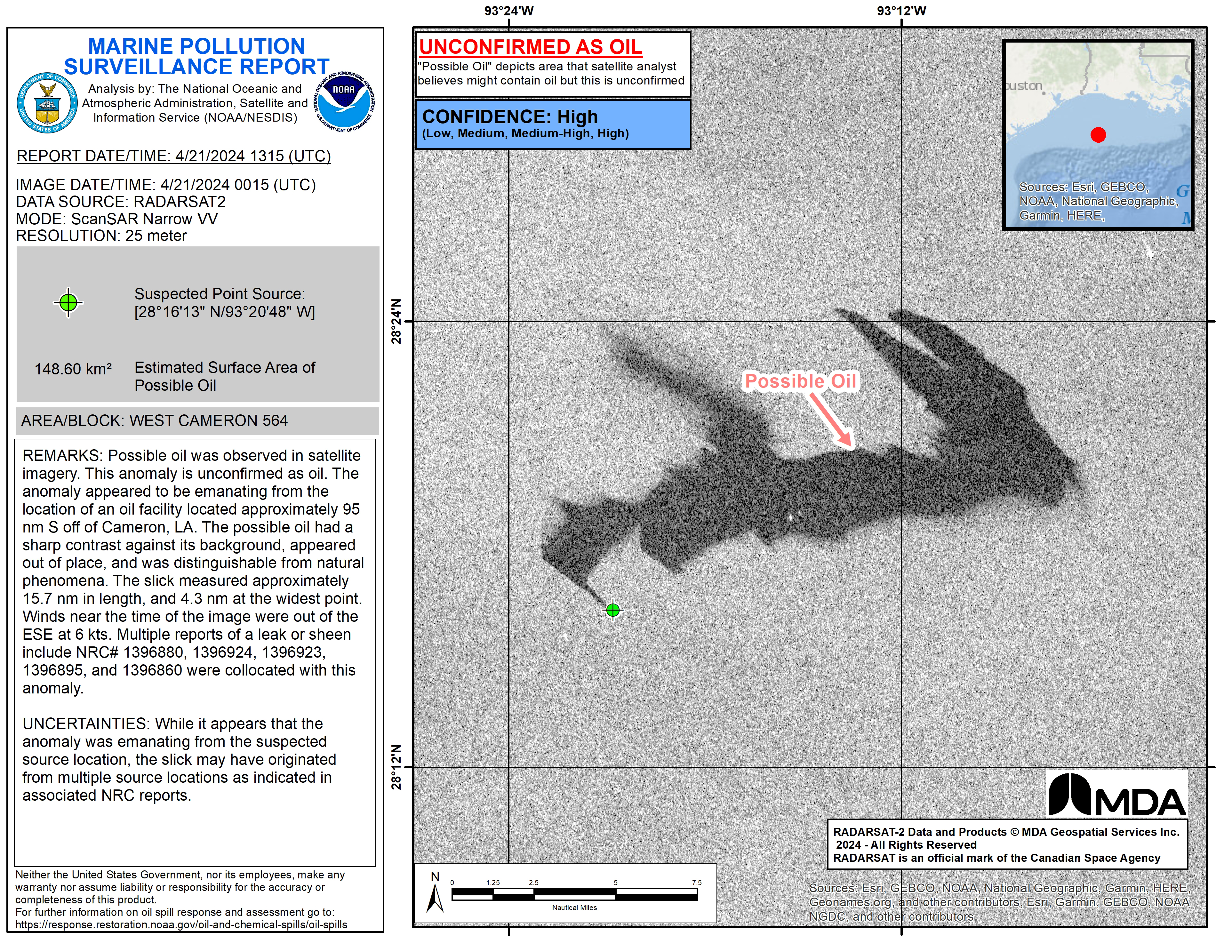
For nearly 20 years, OR&R has collaborated with its partners in NOAA’s National Environmental Satellite, Data, and Information Service (NESDIS) to use satellite information for oil spill emergency response and monitoring and to develop the 24/7 satellite-based Marine Pollution Program. The NESDIS satellite products played an important role in this incident.
On April 20, midstream energy company Energy Transfer experienced a pinhole leak from a 30-inch pipeline in the West Cameron lease block. The discharged product was reported as natural gas and natural gas condensate. Condensate is a light oil that is a byproduct of hydrocarbon drilling.

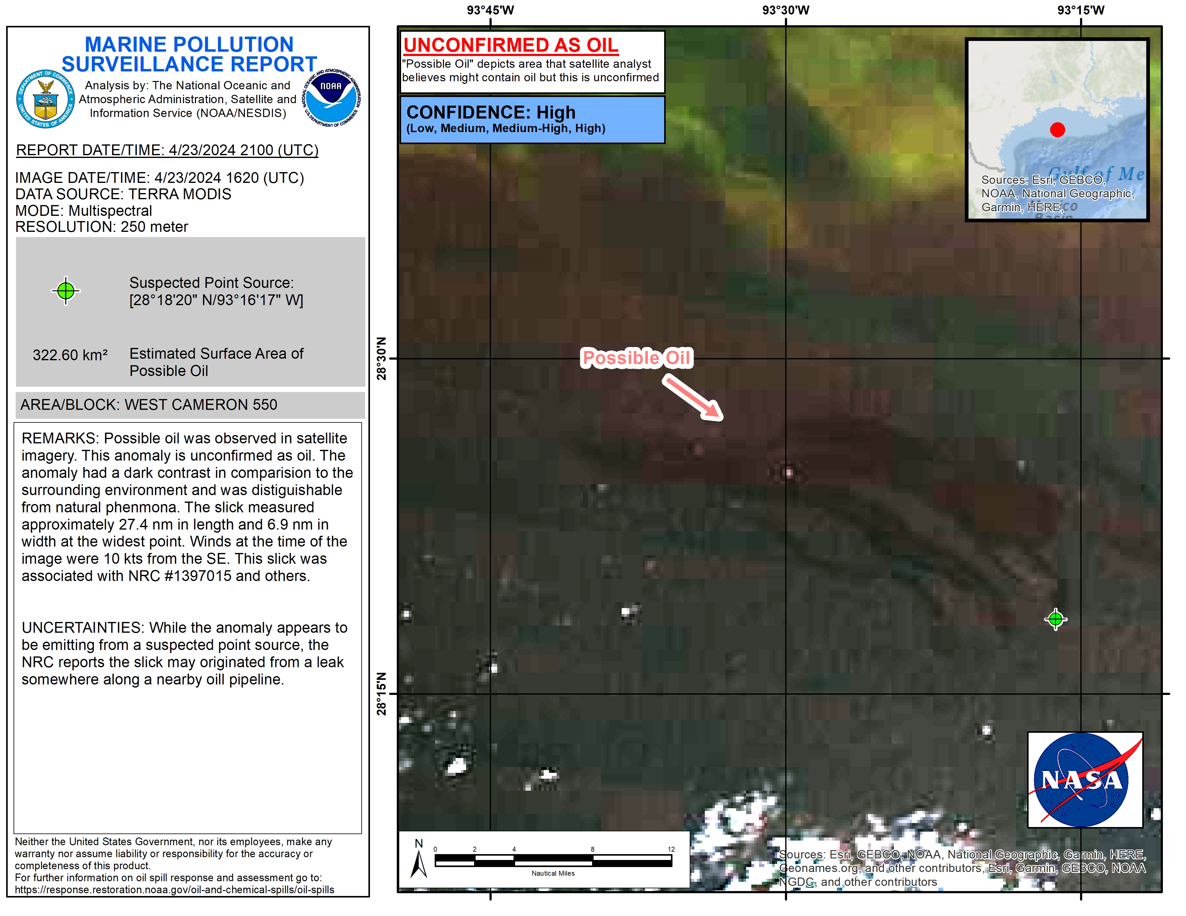
On April 21, NESDIS issued a Marine Pollution Surveillance Report (MPSR), which provides satellite derived analyses of oil location, extent, and relative thickness (when possible). Following a second MPSR issued on April 23, the Louisiana Oil Spill Coordinator's Office contacted the NOAA Scientific Support Coordinator to request an evaluation of the fate and transport of the discharge over concern that the surface oil might reach Louisiana state waters.

OR&R’s oceanographic specialists developed an initial trajectory forecast based on discharge locations derived from the MPSRs. At that time, no chemical data was available for the condensate, for which chemical composition can vary widely. The initial trajectory showed that oil was unlikely to affect Louisiana state waters, as the surface expression was moving towards Galveston, Texas.
On April 24 and 25, NESDIS issued two more MPSRs which revealed condensate discharges from the pipeline had occurred at two additional locations. A Safety Data Sheet, obtained by the USCG from Energy Transfer, indicated the condensate was composed primarily of short, straight-chain hydrocarbon compounds, which volatilize quickly. Based on the additional MPSR and condensate data, OR&R developed an updated trajectory which showed discharged condensate would not reach Texas state waters, and 70-80% of the condensate should evaporate within 24 hours.
Here is the complete list of April's incidents. Click on the links to find out more:
- Pipeline Leak, West Cameron Lease Block 564; Offshore Louisiana
- Fishing Vessel Lil’ Monster Sunk; Makah Bay, WA
- Tug Island Venture Grounding; Squaxin Island, WA
- Disabled USCG Vessel; Dungeness Spit, WA
- Mystery Sheen; offshore North Bend, OR
- Floating Tar Patties from Dismantling of Hilcorp Boudreaux Canal Barge; Chauvin, LA


