The Deepwater Horizon oil spill began on April 20, 2010, with a blowout of BP’s Macondo drilling platform in the Gulf of Mexico. In addition to the death of 11 men, the spill resulted in the largest mobilization of resources addressing an environmental emergency in the history of the United States. The size of the spill required the Emergency Response Division to refine tracking subsurface oil, flowrate calculations, and long-term oil transport modeling. Data and information management became a paramount issue ...
By Alyssa Gray, NOAA's Office of Response and Restoration
Eight years ago today, on April 20, 2010, an explosion on the Deepwater Horizon Macondo oil well drilling platform tragically killed 11 workers, and started the largest marine oil spill in U.S. history, releasing millions of barrels of oil into the Gulf of Mexico.
By Alyssa Gray, NOAA's Office of Response and Restoration
This blog covers information that will be presented by NOAA Office of Response and Restoration Senior Scientist Lisa DiPinto at the AAAS Conference this week. To check out other presentation topics, visit the AAAS Conference website.
The 2010 Deepwater Horizon oil spill resulted in significant environmental harm over a large area of the Gulf of Mexico and adjacent shorelines.
A special issue of Marine Ecology Progress Series published Aug. 3, 2017, features 9 scientific articles summarizing the impacts of the oil spill on northern Gulf of Mexico shorelines and nearshore areas. The scientific studies, conducted by National Oceanic and Atmospheric Administration authors and partners, document four key findings based on five years of data collection and study.
The environmental toll from the 2010 Deepwater Horizon oil spill disaster was enormous, demanding a massive deployment of people and materials to measure the adverse effects.
Federal and state agencies worked quickly to scale up the emergency response, clean up the spill, mount a large-scale effort to assess the injuries to wildlife and other natural resources, and record how these lost resources adversely affected the public.
Gulf of Mexico Oil Spill Data: New Monitoring Updates
By Alexis Baldera
alyssa.dillonTue, 12/20/2016 - 18:52
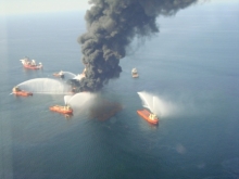
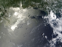
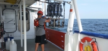
The 2010 Deepwater oil disaster in the Gulf of Mexico revealed a challenge with the way scientific monitoring information is shared and stored.
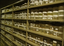
At the time, the scientific records of monitoring efforts in the Gulf of Mexico were dispersed across many entities from universities, natural resource management agencies, private industries to non-governmental organizations. In most cases monitoring systems were developed independently, often narrowed to specific questions, such as how many oysters should be harvested and how many should be left in the water?
One foggy morning in 2007, a cargo ship was gliding across the gray waters of San Francisco Bay when it ran into trouble, quite literally. This ship, the M/V Cosco Busan, struck the Bay Bridge, tearing a hundred-foot-long gash in its hull and releasing 53,000 gallons of thick, sticky fuel oil into the bay.