Every month, NOAA’s Office of Response and Restoration’s (OR&R) Emergency Response Division (ERD) provides scientific expertise and services to the U.S. Coast Guard (USCG), ranging from producing oil spill trajectories that estimate where a spill may spread; to identifying possible effects on wildlife and fisheries; to estimating how long oil may stay in the environment. We also receive requests to track and model other floating objects, such as log booms or shipping containers that have broken free, whale carcasses, fish die-offs, and algal blooms.
So far this year, we have responded to 80 incidents. During May, ERD provided response support for 26 incidents, including 19 new incidents in 10 states. Eighteen of the new incidents were actual or potential oil spills, and one was a chemical spill in the Detroit River, Michigan.
OR&R staff prepared 269 incident reports and documents, including eight fate and trajectory analyses. Six of the incidents this month were unknown volumes, but thirteen of the incidents had volume estimates. Cumulatively, these incidents posed an approximate risk of more than 63,000 gallons of oil and chemicals.
Note: All spill volumes are approximate and based on initial information that may be updated after further investigation.
Here are some of the incidents we worked on during May:
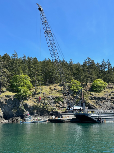
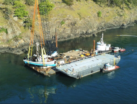
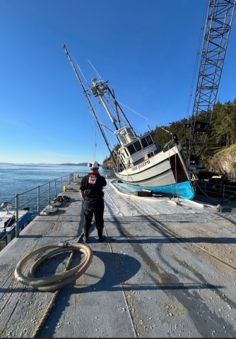
Commercial Fishing Vessel Sunk; Henry Island, San Juan Islands, WA
On May 3, USCG Sector Puget Sound contacted the NOAA SSC to advise that the 48-foot commercial fishing vessel Chief Joseph had sunk in approximately 40 feet of water on the southwest side of Henry Island in Washington State’s San Juan Islands.
Initially, this incident was a USCG search and rescue operation. The vessel sank in a remote location with no easy land access for assessment. The boat operator and his dog had departed the vessel aboard a life raft and were successfully rescued from the shore of Henry Island. They were transferred aboard the USCG Cutter Adelie and transported to Port Angeles, Washington in stable condition.
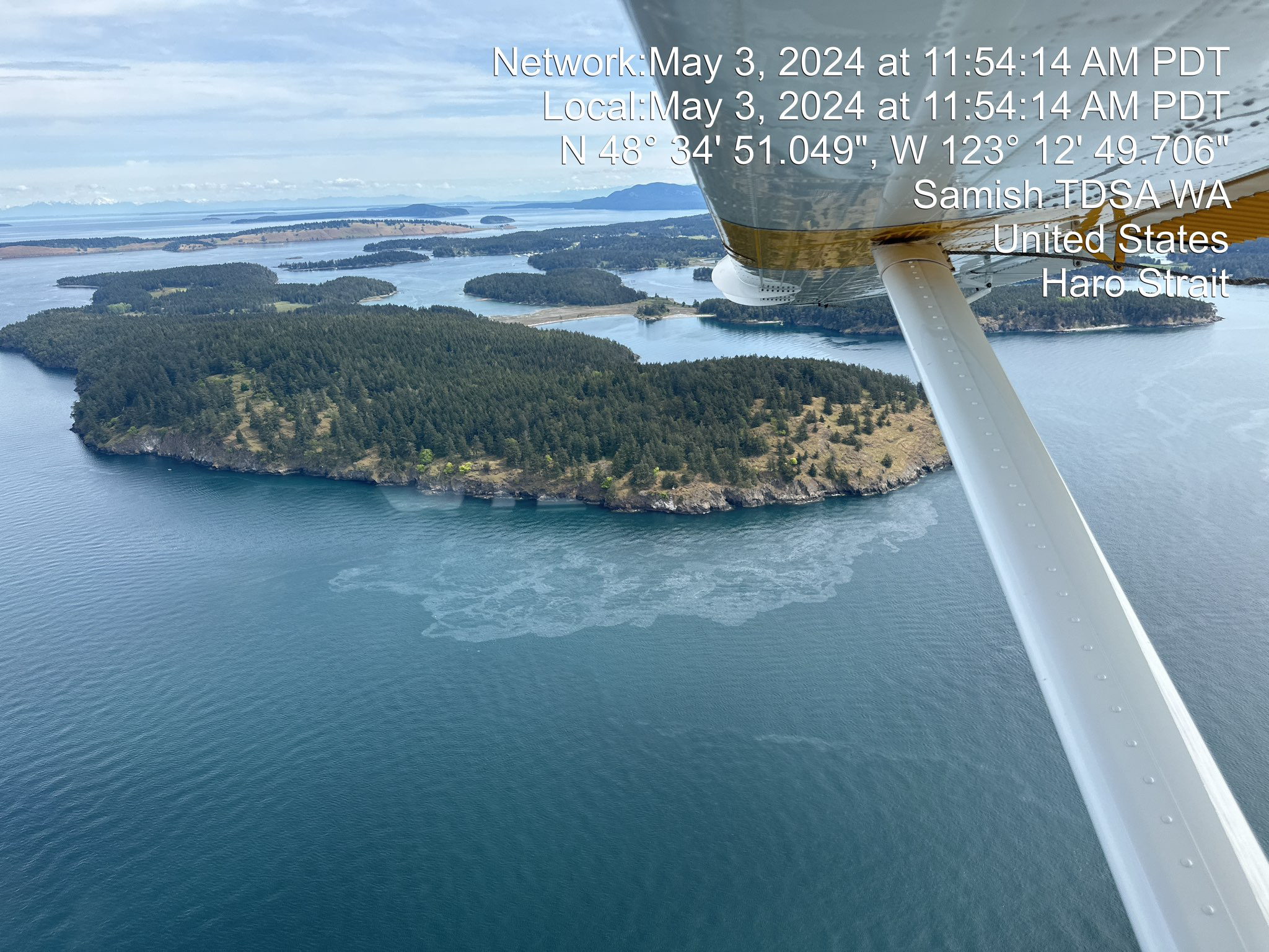
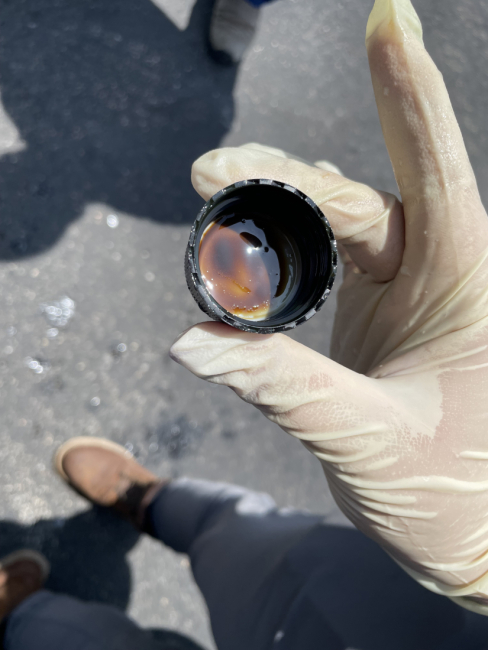
The USCG reported that the Chief Joseph’s maximum fuel capacity was 850 gallons; however, the owner reported that only 400-500 gallons were on board. USCG helicopter aircrew conducted an overflight of the area and reported a 100-yard sheen on the water and a debris field from the sunken vessel.
At the request of Washington State Department of Ecology, NOAA provided a summary of the natural resources at risk in the area. During the salvage period of the response, NOAA’s Scientific Support Coordinator (SSC) provided daily National Weather Service point forecasts, or forecasts for a specific point in a marine zone.
The incident’s Unified Command, consisting of USCG, Washington State Department of Ecology, and San Juan County, developed a plan to address the pollution risk remaining aboard the vessel and the operations necessary to secure the vessel and prepare it for defueling. Local tribes were notified and asked to consider participating in the response.
An oil spill response organization was contracted to evaluate the condition of the vessel and mitigate the threat of pollution to the environment. Several dive and salvage contractors located the sunken vessel with side-scanning sonar in 36 feet of water and deployed equipment to attempt defueling the sunken vessel. An on-scene wildlife emergency organization did not observe any wildlife impacts.
On May 5, the dive team successfully removed all accessible fuel from the vessel—an estimated 1,120 gallons of diesel. The dive team plugged the vessel’s fuel tanks and prepared it to be lifted out of the water. Lift operation was delayed due to weather conditions, but the fishing vessel was successfully lifted on May 11.
The cause of the incident is still under investigation.
Pelican Island Bridge Allision; Galveston, Texas
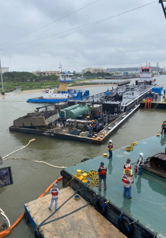
On May 15, the barge MMLP 321 struck the Pelican Island Bridge in Galveston, Texas, resulting in a 20,000 gallon spill of vacuum gas oil, a product used in transportation fuels and many other by-products. Immediately following the incident, USCG contacted OR&R to request a spill trajectory to assist onsite responders. OR&R provided an initial trajectory which correctly predicted shoreline oiling along the western and northern shores of West Bay, a sub-estuary of Galveston Bay, supporting the creation of effective response plans.
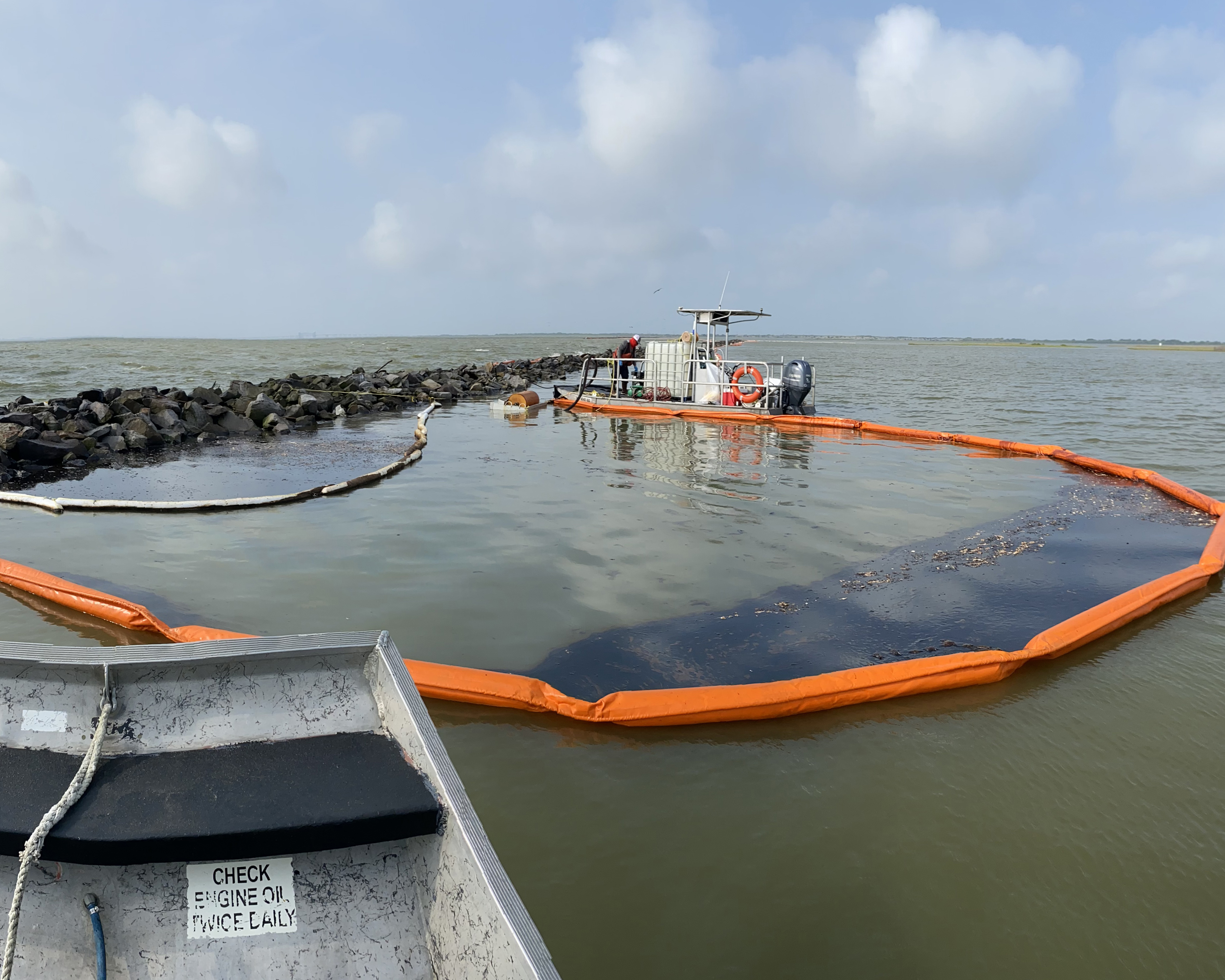
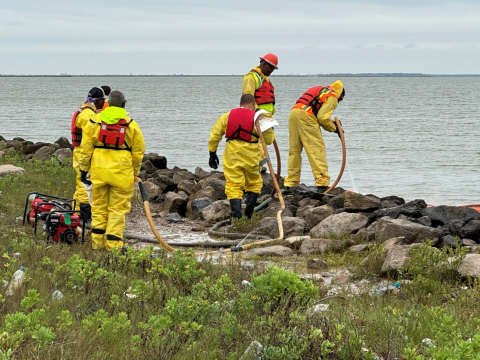
The NOAA SSC and an extended scientific support team deployed on scene to support the response. A portion of the oil transported across West Bay was deposited on marsh islands in the Swan Lake area, a wetland restoration project. NOAA coordinated Shoreline Cleanup Assessment Technique (SCAT) teams and processed SCAT data into maps in order to develop shoreline treatment recommendations to remove oil while minimizing damage to the marsh islands. The NOAA SSC worked with National Marine Fisheries, Texas Parks & Wildlife, Wildlife Response Services, and U.S. Fish and Wildlife to plan and manage wildlife surveys and deterrence measures to reduce potential interactions of wildlife with oil. An OR&R information management specialist collected and archived data from the response.
OR&R is also working with other state and federal co-trustees to conduct a preliminary assessment of the environmental impacts, including potential lost recreational uses, to determine the need to conduct a Natural Resource Damage Assessment.
Natural Gas Condensate Release at Lake Pelto; Cocodrie, Louisiana
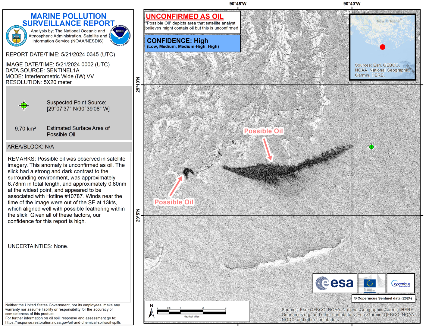
On May 18, USCG notified the NOAA SSC that a vessel struck a decommissioned oil well in Lake Pelto, Louisiana, resulting in an ongoing leak of natural gas and condensate into the air. USCG established a half-mile radius exclusion zone around the wellhead. At the request of USCG, NOAA provided a hazard analysis for the natural gas flammability risk, advice on whether the exclusion zone was appropriate, and fate and trajectory modeling. OR&R modeled the downwind distance where a flammable atmosphere could be present, the results of which supported the safe isolation zone established by the USCG.
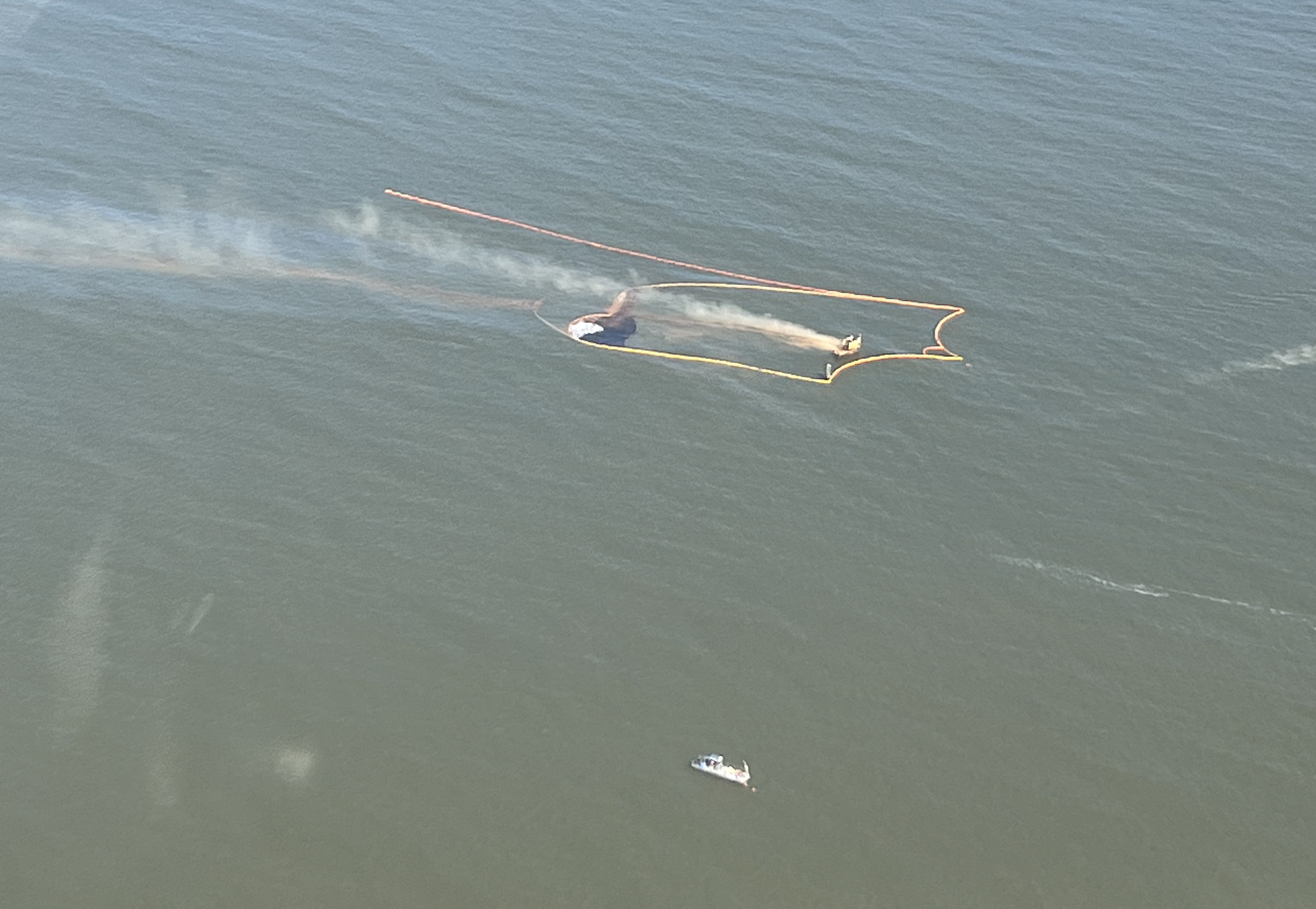
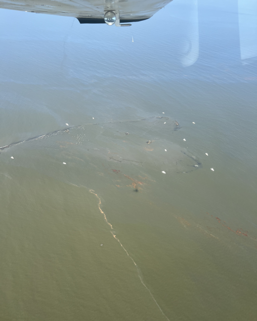
By May 21, the release had been secured. The shoreline impacts were mostly sheen, observed along a few marsh areas, which was considered unrecoverable. Some product remained within containment boom surrounding the wellhead. One small island impacted by sheen was currently inhabited by royal terns, laughing gulls, and a least tern. The U.S. Fish and Wildlife Service was notified but did not request any response action.
Marine mammal and turtle surveys were conducted by a wildlife stranding and rehabilitation organization contracted by the responsible party. Photos captured by the group included dolphins transiting through the released product. No sea turtles were observed during survey efforts.
By May 28, the decontamination process was complete and all spill boom had been removed from the site.
Mystery Tarballs and Oiled Birds on Pacific Northwest Coastlines
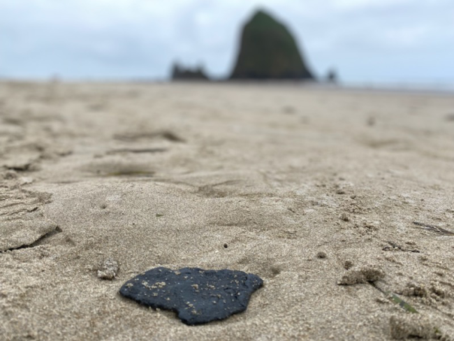
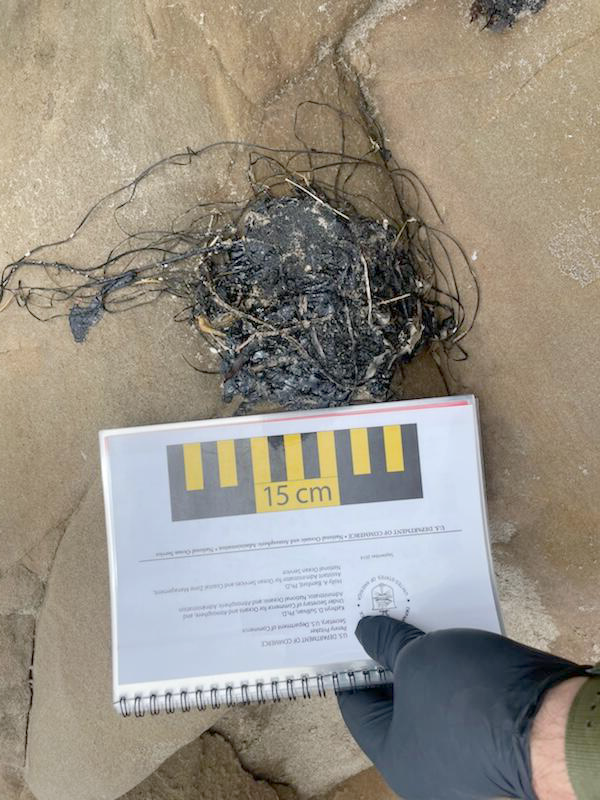
On May 19, USCG Sector Columbia River contacted the NOAA SSC about mystery tarballs and oiled birds observed on northern Oregon and southern Washington coastlines. Reports of small amounts of tar-like oil were reported as far south as Newport, Oregon and north up to Long Beach, Washington. USCG also received reports of six oiled birds on Cannon Beach and Manzanita Beach in Oregon, with one bird needing to be euthanized.
USCG helicopter overflights conducted on May 19 did not detect any oil; however, responders from Washington State Department of Ecology deployed on scene and discovered a stretch of beach with a substantial amount of tarballs within the wrack line.
At USCG’s request, NOAA provided satellite imagery for the prior 72 hours and oil sample analysis on collected tarballs. Satellite analysis did not detect tarballs or oiled birds from the cloud-free areas of the satellite imagery.
On May 24, a Unified Command was established, consisting of USCG, Washington Department of Ecology, and Oregon Department of Environmental Quality, working with response partners from the Oregon Department of Fish and Wildlife (ODFW), Oregon Parks and Recreation Department, Washington Department of Fish and Wildlife, NOAA, and U.S. Fish and Wildlife Service. NOAA provided support to the Unified Command for more than a week.
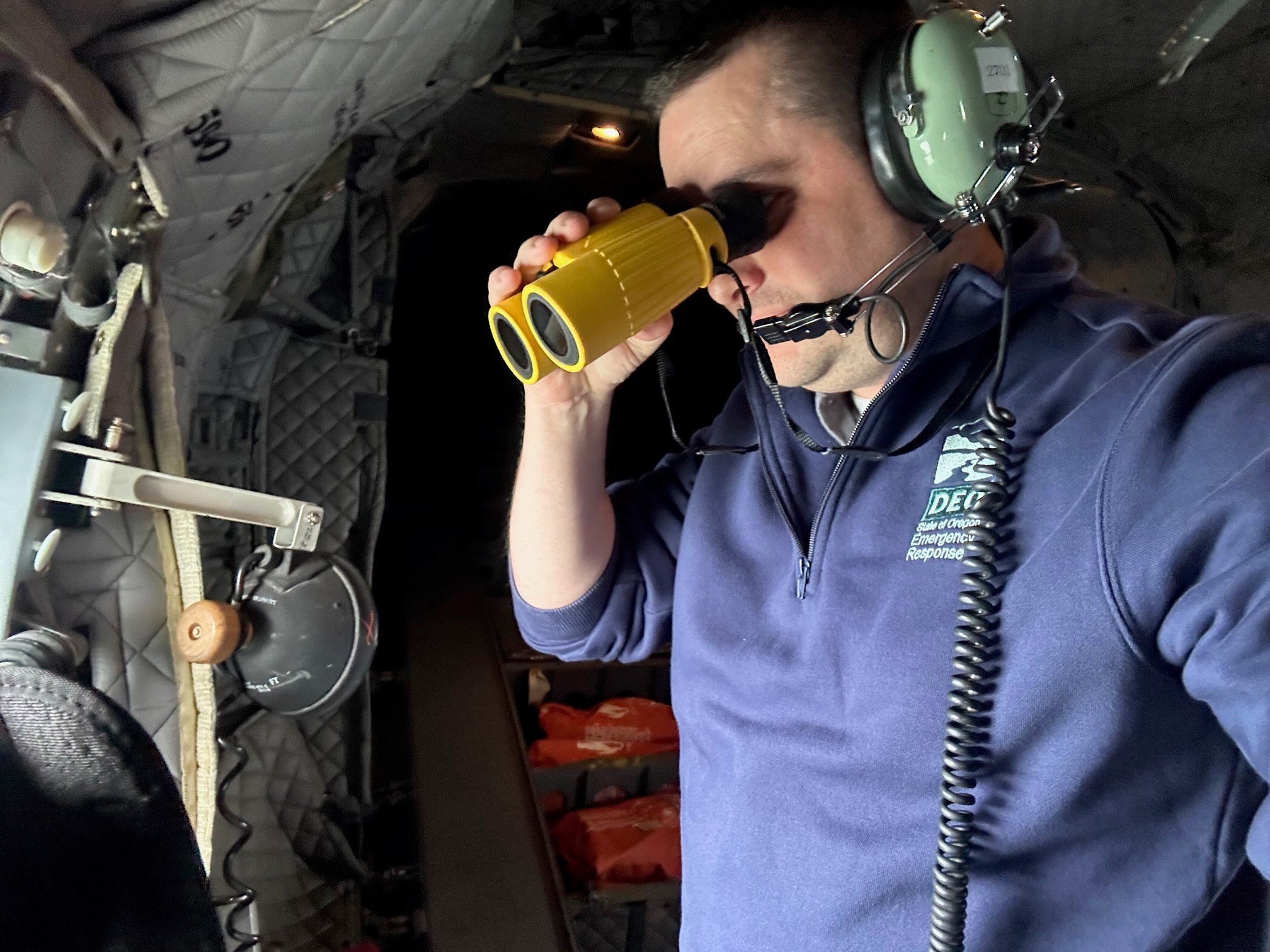
USCG continued to perform overflights along the coastlines to observe any anomalies. A May 25 overflight observed an oil slick described as dull and non-recoverable that was between 1-1.5 miles long and approximately 30 feet wide. The following day, tarballs were observed on beaches near Waldport, Oregon. USCG requested an additional trajectory from NOAA, which included overflight observations of a surface sheen, in order to understand other possible shoreline impact locations.
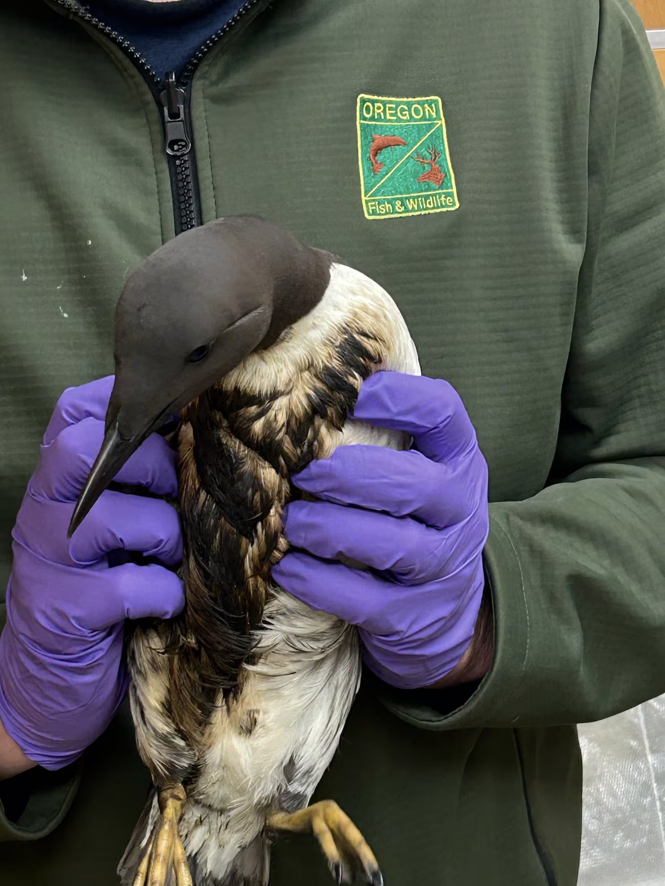
SCAT (Shoreline Cleanup Assessment Technique) surveys were conducted on Washington and Oregon beaches. A SCAT team in Seaview, Washington found eight different species of oiled and deceased wildlife: deceased seals and sea lions, with no obvious cause of death identified; three dead oiled common murres; and one oiled bald eagle. ODFW had reports of up to 10 oiled birds in Oregon, mostly common murres. Tarballs found on beaches were fairly consistently sized, with the largest being sand-dollar sized. As shoreline surveys progressed, OR&R provided recommendations for the cleanup endpoints, or the degree of shoreline “cleanliness” based on the cleanup objectives.
Responders were aware of a dead humpback whale that washed ashore at Nehalem Bay State Park on May 27. NOAA National Marine Fisheries (NMFS) was unable to confirm a cause of death while on scene, but will know more after completing a full necropsy. Upon the initial assessment, there was no obvious cause of death and nothing to suggest any connection with the tar washing ashore.
Among the resources at risk during this incident were protected nesting grounds on Oregon beaches for a small shorebird, the western snowy plover.
The USCG and other agencies continue to work together to determine the source for this incident.
Here is the complete list of May’s incidents. Click on the links to find out more:
- Hydraulic Fluid Discharge; Offshore Freeport, TX
- Cow Bayou Tank Farm Discharge; Orange, TX
- Silver Bay Marine Diesel Spill; Silver Bay, MN
- Delaware City Refinery Oil Spill; Delaware City, DE
- 80-foot Yacht Atlantis Taking on Water; St. Augustine, FL
- Mystery Tarballs and Oiled Birds; Northern OR and Southern WA Coastline
- Natural Gas Condensate Release at Lake Pelto; Cocodrie, LA
- Pelican Island Bridge Allision; Galveston, TX
- Fishing Vessel North American Sinking, Ballard Ship Canal; Seattle, WA
- Waste Oil Discharge, Tucker's Bayou; Deer Park, TX
- Fishing Vessel Sinking near Sandy Point; Ferndale, WA
- Dielectric Fluid Release into East River; New Rochelle, New York
- Mystery Tarball Event near Fire Island; Long Island, NY
- Sheen Reported in Fishermen’s Bend Statter Harbor; Auke Bay, Juneau, AK
- Commercial Fishing Vessel Sunk; Henry Island, San Juan Islands, WA
- Chronic Release of Oil from Pier Nine; San Juan, Puerto Rico
- Request to use Bioremediation Agent on Diesel-contaminated River Shoreline; Nenana, AK
- Discharge of Lubricating Oil into East River; New York, NY
- Fluoracetic Acid Release from Water Authority along the Detroit River; Detroit, MI

