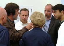
By Charlie Henry, NOAA's Office of Response and Restoration and Director of the NOAA Gulf of Mexico Disaster Response Center
From March 30 to April 20, tune in as we go back in time to the day of our country’s largest marine oil spill, what’s happened since then, and how we’re better prepared for future spills. In this 2015 blog, NOAA Gulf of Mexico Disaster Response Center Director Charlie Henry looks back on his time as the lead scientific support coordinator during Deepwater Horizon and the early hours of the response.
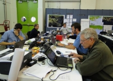
From March 30 to April 20, tune in as we go back in time to the day of our country’s largest marine oil spill, what’s happened since then, and how we’re better prepared for future spills. In this 2013 blog, learn more about how integral data collection and management was during the damage assessment.
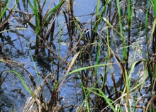
The 2010 Deepwater Horizon disaster spread spilled oil deep into the ocean’s depths and along the shores of the Gulf of Mexico, compromising the complex ecosystem and local economies. The response and the natural resources damage assessment were the largest in the nation’s history. In this 2017 blog, learn more about the natural resources injured by the Deepwater Horizon spill, and how our team assessed those injuries.
The 2010 explosion on the DeepwaterHorizon Macondo oil well drilling platform triggered a massive oil release polluting over 1,300 miles of shoreline along the Gulf of Mexico. The harm from the spill to coastal salt marsh habitat was extensive, and in some instances, permanent. NOAA’s Office of Response and Restoration along with other federal and state agencies measured the spill’s effects and created a restoration plan as part of the Natural Resource Damage Assessment (NRDA).
By Katie Wagner, Amy Merten, and Michele Jacobi, Office of Response and Restoration
From March 30 to April 20, tune in as we go back in time to the day of our country’s largest marine oil spill, what’s happened since then, and how we’re better prepared for future spills. In this 2015 blog, take a look at how one tool helped responders to map the "organized chaos" of the spill.
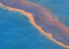
By Doug Helton, Office of Response and Restoration
Oil spills raise all sorts of scientific questions, and NOAA's job is to help answer them. We have a saying that each oil spill is unique, but there is one question we get after almost every spill: Where will the oil go? One of our primary scientific products during a spill is a trajectory forecast, which often takes the form of a map showing where the oil is likely to travel and which shorelines and other environmentally or culturally sensitive areas might be at risk ...