

When you think of California, some of the first things that come to mind might be sandy beaches, surfing, or sea otters floating in the kelp beds off the coast. It makes sense—the state has 3,427 miles of tidal shoreline! Along with these wild and wonderful natural resources, many important human resources line the coasts of the Golden State as well. Protecting these resources over thousands of miles is a tough job, but the first step is knowing what is there to protect.
NOAA’s Environmental Sensitivity Index program provides maps and data showing natural and human resources along California’s coast, as well as the rest of the nation’s coastline, and is a key tool for oil spill response planning and implementation.
The ESI maps and data are a compiled resource containing biological data such as mapped wildlife areas and sensitive tidal marshes, shoreline classifications such as rocky cliffs or sandy beaches, as well as human use data including parks, boat docks, and more. The data are primarily organized and classified based on sensitivity to oil and chemical spills, but they are used for a wide variety of planning, response, and permitting cases.
Recent examples of oil spills have shown the urgent need to understand what resources are at risk in the event of a spill. ESIs present this information in a quick visual format and help responders develop appropriate tactics and strategies for response in consideration of the specific resources at risk.
ESI Partners in California
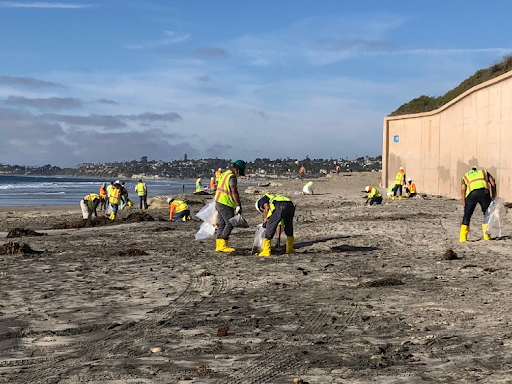
Responding to a marine oil spill involves federal, state, and local agency partners. The California Department of Fish and Wildlife’s Office of Spill Prevention and Response (OSPR) is the lead state agency for oil spills to water, and they are frequent users of ESI maps and data.
The environmental scientists, oil spill prevention specialists, law enforcement officers and other technical experts at OSPR lead prevention, preparedness, and response efforts throughout the state, responding to hundreds of spills each year. OSPR staff query the ESI shoreline data regularly as part of their work to understand and protect the biological and other resources at risk from an oil spill. The ESI data are typically accessed through OR&R's mapping tool ERMA® (Environmental Response Management Application).
ERMA is a critical tool spatially integrating a vast array of information such as ocean currents and tides, transportation infrastructure (such as railroads, highways, pipelines, and shipping lanes), and ESI natural resources data. ERMA allows OSPR users to search ESI data using a query tool to identify known resources present in an area of concern. During an oil spill, ERMA is a major hub for responders to access the latest trajectory and other data from the incident and compare it with identified resources from ESIs.
Responders from OSPR are highly knowledgeable about the resources throughout their state and have moved away from paper maps that were once part of every response. The digital resources available through ERMA are critical to their efforts to populate a common operating picture for responders during a spill. The ability to integrate ESI data and identify what type of shoreline is present in an area, and to quickly compare the latest spill trajectory with potentially impacted resources, is crucial in the early hours of a response when every minute counts to avoid and minimize damage.
New ESIs for the Bay
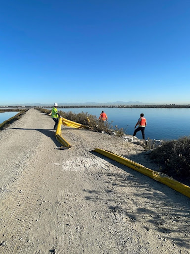
It is critically important that responders know the ESI data are accurate and up to date. The maps for California’s coast were last updated between 2006 and 2010. The San Francisco Bay and Delta ESI maps are among the oldest salt-water ESI atlases in the contiguous United States, last updated by NOAA in 1998. While the maps from this time are still valuable, there have been changes to the coast in the last two decades that need to be incorporated. San Francisco Bay is an area of high vessel traffic and could suffer large environmental and economic impacts from an oil spill.
As a partner to NOAA, OSPR is in the process of updating shoreline maps for ESI. Its staff completed the update to the shoreline data for the San Francisco Bay and Delta in 2021, which included necessary steps such as removing old infrastructure that no longer exists, updating the classification of areas that have been restored, and matching the changing coastline to new satellite imagery. They plan to continue updating the shorelines and assessing biological mapping and other content for the California coast in the future.
California’s environmental agencies know how important current ESI data and maps are for response, planning, and more, and by updating the shoreline data, they are serving as an important leader in the field. NOAA’s ESI guidelines provide a national standard to ensure consistency in presenting ESI data for responders who rely on them nationwide.