
A natural disaster such as a hurricane impacts all facets of life in a community, and can even cause ripple effects that spread beyond the area of landfall to impact distant places and people. This far-reaching impact can be a devastating reminder of the interconnected nature of the blue economy, connecting people across the globe through sustainable economic activity alongside environmental protection. NOAA’s Office of Response and Restoration (OR&R) supports this blue economy through response and planning activities that protect critical infrastructure and marine resources, as seen in the 2022 response to Hurricane Ian in Florida.
As Hurricane Ian bore down on the Gulf coast of Florida in September 2022, early reports indicated that Tampa Bay could be directly in its crosshairs. This could have turned into a worst-case scenario for the region, as the Tampa area has grown rapidly and is an economic engine for the state. Port Tampa Bay moves 33 million tons of cargo per year, and affects 85,000 jobs directly and indirectly. It serves more than 9 million residents in the Tampa Bay/Orlando corridor with an economic impact of $17.2 billion. A direct blow could have been devastating to the region, potentially shutting down commerce and tourism for an extended time.
While Hurricane Ian ended up coming ashore south of Tampa and spared the region the worst impacts, there were still impacts for the port. Tampa Bay experienced a “reverse storm surge,” as water was rapidly pulled out to sea by the hurricane’s winds, dropping the Bay’s depth by more than seven feet in places. Due to this and concerns about the storm, Port Tampa Bay was closed from Sept. 27-30.
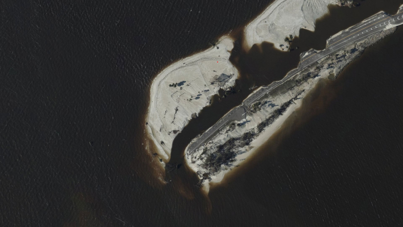
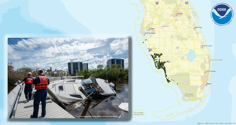
Elsewhere in the state, the storm’s devastation included collapsed bridges, flooded roadways and homes, and thousands of sunken and derelict vessels, causing a massive marine debris problem for the region. OR&R responded to this emergency situation for more than two months, with over 35 staff from across OR&R dedicating more than 5,000 hours to support incident response both in-person and remotely. OR&R embedded NOAA scientific support coordinators, contractors, GIS specialists, and marine debris experts with the U.S. Coast Guard in both Miami and St. Petersburg.
OR&R scientists discovered and determined the location of oil and hazmat releases or debris posing threats to life, safety, the environment, and/or maritime transportation systems. Updates were provided in real time to other responders, drawing also from aerial imagery captured by NOAA’s National Geodetic Survey that helped identify more than 6,200 potential pollution risks.
OR&R also trained more than 130 assessment team members from the U.S. Coast Guard and Florida Fish and Wildlife Conservation Commission in the use of a field data collection tool called VADR (Vessel, All-hazards, and Debris Response tool), which was designed to identify and track sunken and stranded vessels. The collection, analysis and visualization of these images greatly assisted affected regions by helping reunite owners with their boats, facilitating the removal of derelict vessels and debris from waterways, assisting the Coast Guard in clearing potential pollution sources from the environment, and supporting safe navigation.
The breadth of expertise utilized in this response reflects how OR&R will be critical to keeping facilities within the Port of Tampa Bay functioning in the event that it experiences a direct hurricane strike in the future. OR&R’s rapid response, tools, and scientific expertise help minimize disruptions, speed up the reopening, and keep ocean-based economic corridors open and functioning.