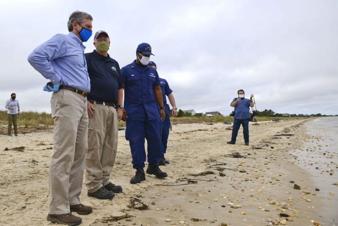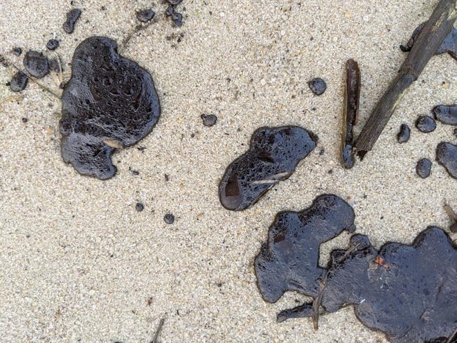
On a relatively quiet afternoon on Oct. 19, 2020, the U.S. Coast Guard notified NOAA’s Frank Csulak that tar balls and oiled debris were scattered across approximately 12 miles of Delaware Bay’s shoreline. As the scientific support coordinator for the Mid-Atlantic Region in NOAA’s Office of Response and Restoration, Frank is used to such calls and began working with his team on the trajectory, weather, and tidal information.
The impacted area in the bay extended from Prime Hook Refuge to Cape Henlopen, Delaware. In the spring, this area provides habitat to hundred of thousands of horseshoe crabs that come ashore to lay their eggs, followed by the arrival of tens of thousands of migrating birds—specifically the red knot and oystercatchers, two federally protected endangered species, that feed on the horseshoe crab eggs. Because of these species, NOAA also provided an informal Endangered Species consultation.
However, within a few days of the initial tarballs washing ashore, those 12 miles of oiled shorelines turned into more than 60 miles of impacted shoreline—extending from Prime Hook Refuge, to Cape Henlopen State Park, to Fenwick Island south to northern Assateague Island, Virginia.
In addition to the Coast Guard and OR&R’s Emergency Response Division, additional agencies and organizations that responded to the oil spill included the Delaware Department of Natural Resources and Environmental Control, U.S. Fish and Wildlife Service, Maryland Department of the Environment, Virginia Department of Environmental Quality, and Tri-State Bird Rehabilitation and Rescue. Lewis Environmental was contracted by the Coast Guard as the oil spill response organization to provide the man-power and equipment to remove the oil from the impacted shorelines.
To date, the Coast Guard has not been able to identify the source of the spill. As a result, Coast Guard Sector Delaware Bay opened the Oil Spill Liability Trust Fund to cover the costs of the response. Initially, it was thought that several vessels involved in a lightering operation in Delaware Bay a few days prior to the oil coming ashore may have been the source, but after collecting source oil samples from these vessels, including tracking one vessel to Corpus Christie, Texas, the Coast Guard’s Marine Safety Lab, located in Connecticut, was not able to “finger print” a match between the source oil samples and the field samples. NOAA also made arrangements through Louisiana State University’s chemistry department, to analyze the tarballs. Laura Basirico, an LSU chemist, concluded that the oil was a “fresh” oil, probably a refined high aromatic heating or diesel fuel oil.

Since there are several nearby wrecks offshore from New Jersey and Delaware, that raised the question, could one of these wrecks, especially those that were sunk by German u-boats in the early 1940s, be the source? Christopher Barker, an oceanographer at OR&R, prepared several different trajectory models using these known wrecks as a potential source. Unfortunately, the modeling showed that it was extremely unlikely that any of these wrecks were the source. We also reached out to NOAA’s National Environmental Satellite, Data and Information Service Satellite Analysis Branch (NESDIS). NESDIS operates a fleet of environmental satellites that provide critical world-wide imagery of significant weather and environmental events. For this case, we reached out to Juan Velasco, an ocean remote sensing operations officer in NESDIS, for imagery support. Unfortunately, even with several days of excellent satellite imagery of the shipwrecks located off the coast of New Jersey, Delaware, and Maryland, imagery did not detect any oil leaks from the vessels. To further support the Coast Guard’s efforts to identify a source, U.S. Coast Guard District 5 arranged for C-130 fisheries flights to fly over the wrecks as part of their patrol missions. So far, these fishery flights have not detected any oil being discharged from any of the nearby wrecks.
With regard to the old question, “How clean is clean” in terms of removing oil on the beaches, Jacqui Michel, a NOAA contractor recommended that the clean-up end point for this spill be to remove all tarballs larger than “dime” size or larger than 3 cm and to remove all oiled debris. Employing mostly manual removal, with the use of some mechanical beach rakes, all visible oiled wrack and tar balls were removed by the contractors—totaling 85 tons.

As of Nov. 13, the Coast Guard deemed the response complete along all Delaware, Maryland, and Virginia shorelines. However, the Coast Guard will leave the federal project number associated with this incident open until Dec. 11. If the Coast Guard receives any new reports of oiled wrack or tar balls, clean-up contractors will be re-activated. If any oiled wrack or tar balls are sighted after Dec. 11 and requiring cleanup, this may require a separate Coast Guard response.
In summary, this spill response demonstrated a successful collaborative effort of the first responders, assessment teams, investigators, and response workers who spent weeks cleaning the shorelines of Delaware, Maryland, and Virginia. The collaborative effort under the Unified Command accomplished its goals of cleaning up this spill and protecting our shorelines.