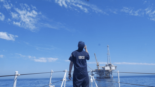
A hundred miles off the coast, a vessel grounds, leaking thousands of gallons of oil and endangering sensitive marine and coastal environments. What happens next? The U.S. Coast Guard arrives on the scene immediately. And, NOAA’s Office of Response and Restoration (OR&R) follows. The Coast Guard and NOAA have a longstanding partnership, working together to keep the nation’s waters safe and pollution-free.
The Coast Guard assumes the primary responsibility for managing and responding to oil and chemical spill incidents in coastal waters while OR&R provides the science-based expertise, both on-scene and remotely, to support informed decision-making during an emergency.
Supported by an interdisciplinary scientific team led by OR&R’s Emergency Response Division, the U.S. Coast Guard is the first line of defense to plan a response operation. This response team, along with the responsible party, arrive first at the scene. Their goal is simple: to control and clean up the hazardous material in order to prevent and reduce harm to the environment and human health. But, the journey ahead is complex. From start to finish, the job includes: detecting, examining, and characterizing the oil spill; predicting where it will go; preventing the oil from reaching sensitive areas; cleaning up the oil; assessing the ‘damage’ or harm to the public and natural resources; holding the responsible parties liable for compensation to restore the lost resources; and, finally, restoring the injured resources. This process in totality can take years and sometimes decades. But, the key to it all are the first steps taken at the scene: oil detection, oil characterization, and data collection, steps that OR&R and the Coast Guard are working together to enhance and expedite with cutting-edge science that puts eyes in the sky through the use of Uncrewed Aircraft Systems (UAS) technologies, such as drones.
The Tricky Science of Oil on Water
Oil and water don’t mix. A common fact known in households around the world. So, this should make oil identification easy and straightforward. However, oil and water do “mix” in some cases, creating what is called “emulsions.” And, oil and emulsions in the marine environment are challenging to detect, contain, and recover.
Characterizing spilled oil is critical for responders and their understanding of an event. This process can be achieved through the use of UAS which provide an aerial view of an incident. When describing an oil slick, it’s important to communicate the following properties back to ground: extent, orientation, appearance, distribution, and trajectory.
- Extent refers to the size of the slick; how many square feet or miles it is. What is the ‘footprint’ of the oil slick on the water?
- Orientation refers to the shape or direction of the oil. Some slicks are round or oval, while others stretch out into thin, narrow bands. What direction is it moving?
- Color and appearance is one of the most significant pieces of information. The appearance of spilled oil varies, and can provide insight quickly on how thick the oil is and what oil can be recovered.
- Distribution refers to how the oil has reacted to environmental factors. Is the spill large and clumped in patches? Has the oil spread out into thinner, disconnected streamers?
- Trajectory is a fundamental factor for planning the response operations that could involve: containment, recovery, in-situ burning, or the application of dispersants.
The five factors above can be influenced by environmental conditions and the chemical properties of oil. When monitoring an oiling incident, responders can infer some information about the type of response operations of the incident through the following indicators:
- Viscosity: Most kinds of oil are less dense than water which causes a majority of spilled oil to float on the water’s surface. However, various environmental factors can affect the properties of spilled oil, especially near the surface. For example, waves, currents, and wind can affect the viscosity of oil, or its resistance to flow. A higher viscosity indicates a slower and thicker fluid. A lower viscosity indicates a faster, thinner fluid. Conditions at the water’s surface, like waves, currents, and wind, can spread oil out and push it across the water, reducing the viscosity, affecting the distribution and orientation of the slick, and transforming the appearance (color) of oil.
- Color and appearance: Oil color is influenced by oil type, weather, visibility, and thickness of the oil itself. Thicker sheens of oil are more observable, displaying a vibrant, metallic color or appearing like the true color of oil: dark brown or black. Under certain weather conditions, thick slicks of oil can become “emulsified oil” or “mousse.” Mousse occurs when water droplets have mixed with the oil and can vary in its appearance, from yellow to dull brown to bright red. Thinner sheens of oil are harder to detect. This type of oil has spread out and become less viscous, appearing like a silver sheen, or when slightly thicker, appearing iridescent and displaying a rainbow of colors. The appearance of oil on water can lend critical information when characterizing an incident. Darker oils represent “recoverable” or “actionable” oil. Recoverable oil is oil in a thick enough layer to be extracted by conventional techniques and equipment. Shinier sheens of oil are thinner and typically not recoverable.
- Geography: Despite the stark, obvious differences between oil and water, the ocean environment can present a challenge for locating oil as it reflects sunlight and obscures the view. Location and daylight can help improve oil detection because oil and water reflect sunlight differently. Oil has a natural insulated layer which reflects thermal radiation differently than water. During the daylight, oil can “appear” hotter under thermal imagery against water (this comes in handy later!). Similarly, during night conditions, oil can “appear” cooler than its surrounding water under thermal imagery. The heat storage of oil can help locate the oil and determine its distribution.


Uncrewed Aircraft Systems for Emergency Response
OR&R’s team of Scientific Support Coordinators (SSCs) and technical specialists work hand in hand with the Coast Guard’s Federal On-Scene Coordinators in the event of a spill. The SSCs provide information about the incident’s characteristics, offer models that forecast the movement and behavior of spilled oil, evaluate the risk of resources, and recommend cleanup strategies. The On-Scene Coordinator and the Coast Guard response team execute all control and clean up efforts of the substance.
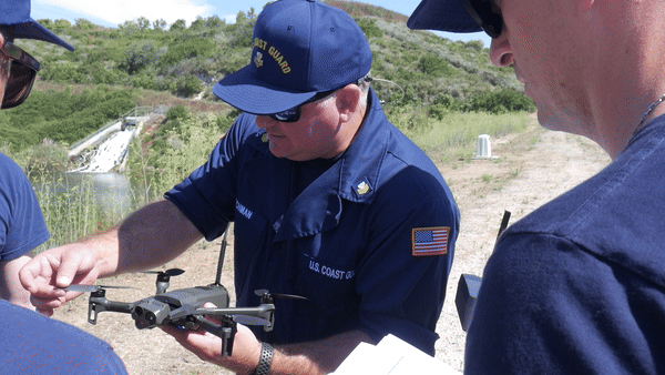
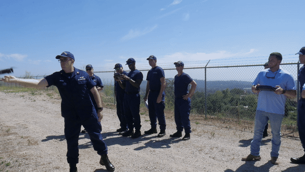
Emergency response efforts are all kicked off by one key process: the documentation of an incident. UAS technologies are critical tools used by first responders to survey the shoreline or surface waters. UAS have the capability to take photos, record videos, capture coordinates and location, and monitor the water. OR&R scientists often use UAS to capture high resolution, geotagged photos, which can be displayed collectively in precise locations on maps.
A key part of UAS imagery for emergency response is capturing photos that overlap with each other, meaning each photo is capturing an overlapped portion of the scene that was also captured from the previous photo. As a result, each image can be “stitched together” to create a single orthomosaic image of the environment or remote sensing map for analysis. This orthomosaic map is an easily read and interpreted product useful to responders and assessors. Another aspect of UAS imagery is the ability to capture and display infrared radiation or the temperature distribution emitted by objects and surfaces. Thermal sensors on drones can provide a visualization of temperature variations in the environment which are associated with the thickness of the oil. As mentioned above, oil has a different heat storage capacity than water. Using aerial thermal imagery, spilled oil may “look” hotter or colder than its surrounding water. This differentiation can help to easily and quickly locate the areas of the spill that have the most remediation value, or the largest volume of oil.


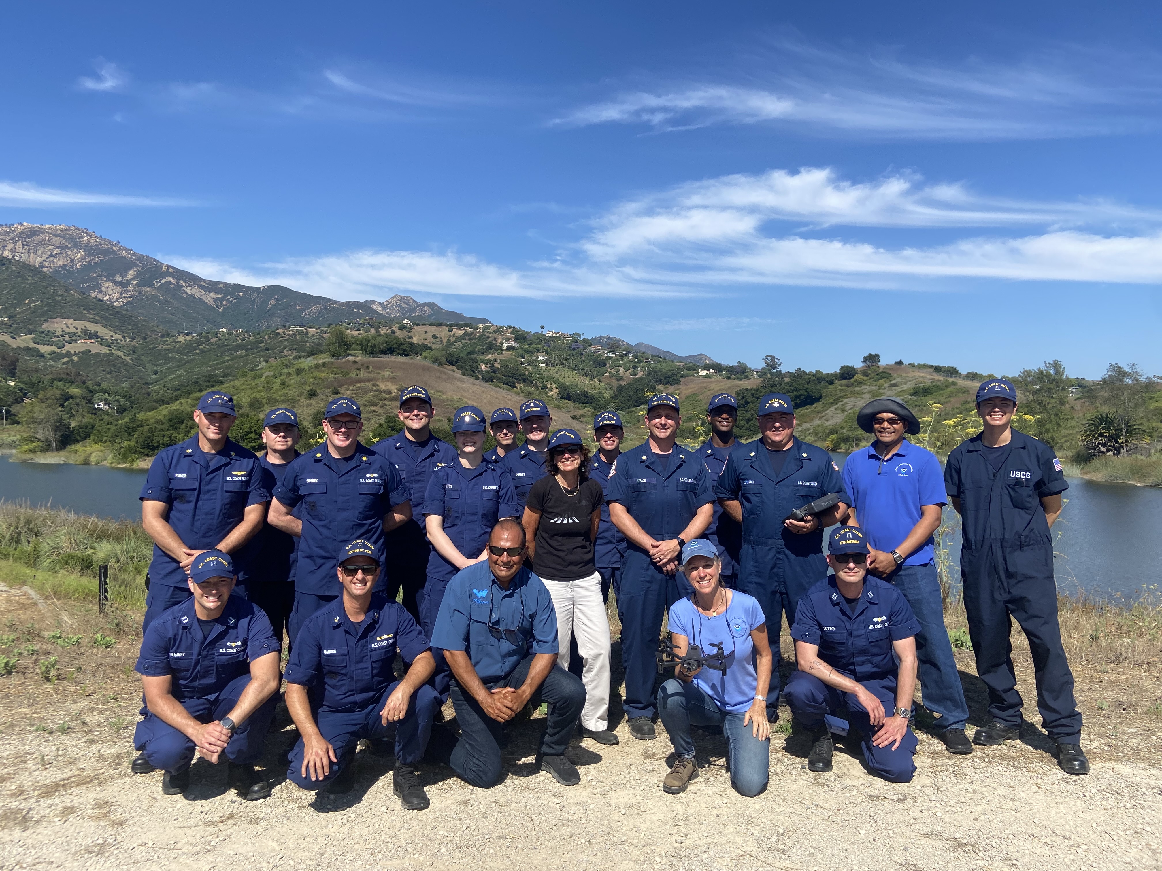
Using this knowledge, OR&R sprung into action and set up a project to advance the skills of the U.S. Coast Guard’s UAS pilots. OR&R’s project goals were to supplement UAS pilot training and strengthen data collection, processing, delivery, and short-and long-term storage that would support timely and impactful environmental response. For a pilot, the mission is to: perform safe drone takeoff, capture geotagged images and videos, perform safe drone landings, upload collected data into OR&R’s data management software Data Integration, Visualization, Exploration, and Reporting (DIVER) that allow for the creation of orthomosaic maps in OR&R’s online mapping tool, Environmental Response Management Application (ERMAⓇ). At the end of this procedure, on-the-ground responders would have a snapshot of the oil spill ready at their fingertips to determine how, when, and where to conduct an emergency response.
“When a spill occurs, we know how important it is to collect the most accurate information about where the oil is, and get it to the responders as quickly as possible,” says Lisa DiPinto, senior scientist with NOAA’s Office of Response and Restoration. “With this project, we are transitioning what we’ve learned from years of remote sensing UAS research and data delivery into operations, and are testing and sharing that knowledge with some of our on-scene first responders to advance oil spill response and recovery work.”