
Classifying oil spill thickness using multiple remote sensors with research born from the Deepwater Horizon assessment.
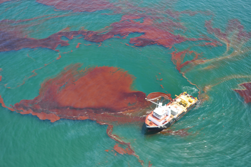
The 2010 Deepwater Horizon oil spill was the largest marine oil spill in U.S history, and responding to the disaster required the use of brand-new satellite technology to detect and map the footprint of oil on the surface of the ocean. A decade later a team of interdisciplinary scientists, many of whom worked on the historic spill, are developing ways to advance satellite technology to do something new — estimating the thickness of oil slicks from outer space.
A recent paper in Remote Sensing of the Environment outlines innovative methods to use satellite technology to measure the thickness of floating oil, then deliver these data to responders faster than ever before. This allows scientists to zero-in on the thick “actionable” oil that can be best cleaned up or contained.


By using multiple remote sensors to measure oil slick thickness at two different locations, and cross-checking their findings with measurements taken by scientists on the water, the researchers verified the accuracy of their improved methods.
These new methods have the potential to be used during oil spill responses in the near future, providing fast and accurate information to emergency responders.
Detecting and Classifying Floating Oil
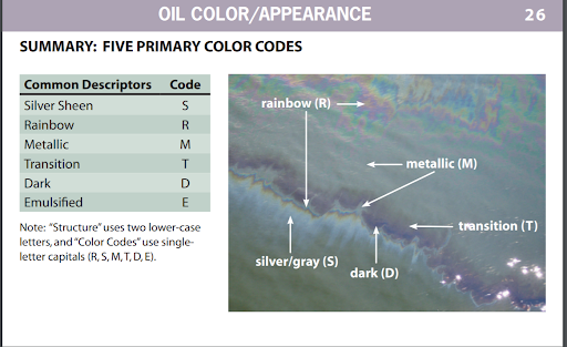
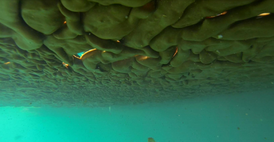
The most common way to estimate oil spill thickness is through visual evaluations of different colors of the oil slick. As the oil spreads and becomes thinner, crude oil changes in color from black or brown to an iridescent or silver sheen.
However, it is not always practical, safe, or affordable to conduct measurements on-site, and satellites can see things that the human eye can’t. Satellite remote sensing can collect information over a greater area, and deliver information more efficiently, than planes in the air or ships on the water.
Satellite Synthetic Aperture Radar (SAR) is commonly used to detect oil slicks by measuring the roughness of the ocean's surface. Oil dampens tiny wind-driven waves and bounces less energy back to the satellite, making oil slicks appear darker than their surroundings. However, SAR hadn’t been used to classify different oil types or estimate slick thickness.
The team of scientists — representing a variety of federal agencies and universities — wanted to see if they could detect the difference between thick crude oil, oil water mixtures, and thin sheens using SAR to detect differences in electrical conductivity and surface texture.
Putting Tools To the Test


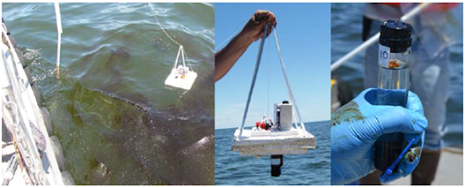
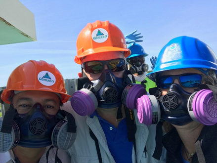
To ensure their methods were as accurate as possible, the researchers used two testing sites. The first was a massive outdoor test tank at the National Oil Spill Response Research and Renewable Energy Test Facility (OHMSETT) in New Jersey, which was selected to precisely control conditions. A second site in the northern Gulf of Mexico was selected to see how their tools worked in open water.
In both cases researchers on the ground measured the thickness of the oil slicks-using dip plates, a specially designed remotely deployed sampling tube, sorbent pads, and other methods to directly measure the oil thickness-while multiple remote sensors zoomed in from above.
This allowed them to compare the snapshots taken by multiple remote sensors, including SAR, to what they knew the actual conditions to be.


Remote sensors on aircrafts and multiple satellite data acquisitions took “snapshots” of the oil spill at the exact same time, allowing researchers to cross-compare SAR’s observations to the other tools. Altogether these optical, multispectral, and direct observations allowed the cross-comparison and validation of the new SAR oil thickness classification.
They found that SAR measurements were capable of differentiating oil from oil mixed with water, both at the OHMSETT tank and in the Gulf of Mexico.
Crude oil of any thickness dampens waves on the ocean surface, creating a less rough water surface and reducing backscatter to the remote sensors. By matching the extent of oil features on SAR and multispectral images, the researchers found specific markers that correspond to “actionable” oil that can be targeted for cleanup.
Delivering Data on Actionable Oil
These findings have significant implications for oil spill response by providing verifiable and timely information on the location and amount of “actionable” oil that can be cleaned up or contained. Just as importantly, this information can be delivered to oil spill responders in near-real-time.
Time is of the essence during oil spills, so accurate and timely data are critical to make informed decisions to minimize impacts to natural resources, as well as the communities and economies that depend on them. These thickness estimates could also help calculate the overall volume of oil spilled more accurately, enabling more accurate assessments of environmental impacts.
In the decade since the Deepwater Horizon oil spill, NOAA scientists have strived to apply and advance what they learned in the Gulf of Mexico to prepare for future spills. We will continue to collaborate with leading experts to push the boundaries of science, ensuring that when disaster strikes again, NOAA scientists are equipped with the best possible tools to respond.
For more information read Classification of oil spill by thicknesses using multiple remote sensors, which is available for free online.