
OCT. 31, 2018 — Deep under the surface of U.S. waters, lying in wait to strike, is an environmental threat the size of an army. This army — while deadly and toxic in its own right — is not made up of soldiers and weapons, but rather of vessels from long ago, now derelict and forgotten.
Scattered throughout coastal waters and left silent and still in the places where they fell, these derelict vessels are relics of wars, battles, disasters, and other shipwrecks from the past. Aged by time and the impacts of a watery grave, these vessels continue to decay and corrode. As their once strong and impenetrable exteriors break down and give way to the forces of the sea, their fuel tanks weaken. Oil and other toxic chemicals begin to rise up from the graveyard below like a phantom ascending a staircase.
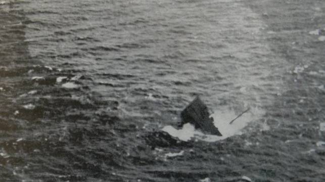
One such vessel — the doomed Coimbra tanker — met its fate on Jan. 15, 1942 near Long Island, New York. A British steam tanker during World War II, the Coimbra was torpedoed and sunk by a German U-boat in the Battle of the Atlantic. As the vessel plunged to its final resting place approximately 20 miles south of the Shinnecock Inlet, it carried with it an estimated 2.7 million gallons of oil.

Most of the oil on board is thought to have spilled or burned immediately following the incident, yet some still remained. Over the years, divers have reported seeing sheens coming from the site of the Coimbra. Though it wasn’t until Oct. 15, 2009 — when the East Hampton Star reported that a recreational diver had surfaced covered with oil after diving on the tanker — that scientists suspected the leakage may be getting worse.
At the time, OR&R’s Emergency Response Division was developing an interagency agreement with the U.S. Coast Guard under which the agencies would work together to address threats from vessels sunk off U.S. shores that contain significant volumes of oil. In 2010, Congress appropriated $1 million to NOAA to prioritize the potential pollution impacts of individual shipwrecks. Under this project, known as the Remediation of Underwater Legacy Environmental Threats (RULET), NOAA and the U.S. Coast Guard set out to identify the most ecologically and economically significant potentially polluting wrecks in U.S. waters.
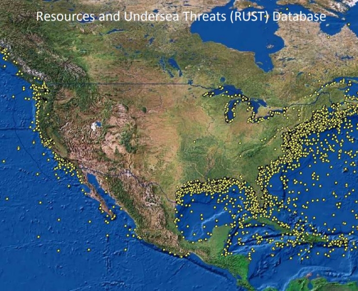 The agencies began by looking into about 20,000 known shipwrecks. They narrowed their search down by the age of the vessel and the incident, the type of vessel, and the circumstances that led to the vessel’s demise. World War II wrecks, especially tankers like the Coimbra, were prioritized for their large cargo volumes. The results of the study produced a database of the names and locations of the most potentially environmentally hazardous wrecks — zoning in on 87 high level risk wrecks. Those sites are routinely monitored by the NOAA Satellite and Information Service Satellite Analysis Branch using high resolution visible satellite imagery and Synthetic Aperture Radar.
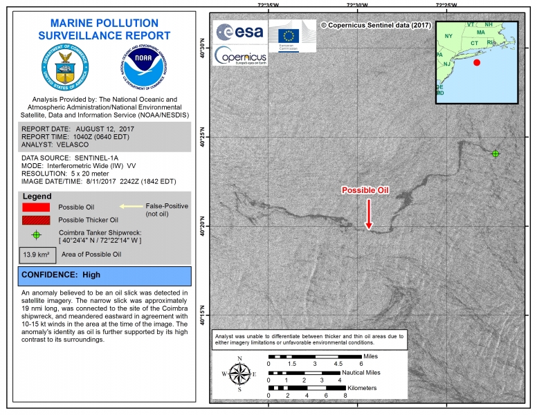
Satellite observations are an ideal method for surveillance, as several of the shipwreck sites are well offshore and possibly out of range for routine overflights. For every satellite detection of an anomaly associated with a RULET wreck, a Marine Pollution Surveillance Report (MPSR) is generated and disseminated to responders in NOAA’s Office of Response and Restoration, the U.S. Coast Guard, and others. Analysis is predominantly conducted using free-source publicly funded environmental data, and reports are produced in a 24/7 operational setting to ensure the information can be acted upon (if need be) in a timely manner.
The reports serve as documentation of a chronic release, and also provide the spatial extent of the pollution that reaches the surface. Discharge rates can change over time due to continued degradation of the fuel tank, or after the passage of a tropical cyclone, etc., and so it’s critical to continue to monitor and report on the oil releases even though they’re well known. The number of report issuances for a given wreck can also aid responders in the decision making process, by helping prioritize the order in which the ships are scheduled to have their oil cargo removed, or possibly have the vessel extracted altogether, both of which can be dangerous and costly.
The surface expression of oil is not always present, but depends largely on underwater currents and surface wind speed. Conversely, there are times when oil is present, but not detectable due to unfavorable environmental conditions or limitations in the satellite sensor. For example, SAR imagery cannot detect surface slicks in low wind conditions, 5 knots or less, or high wind conditions, exceeding 15 knots, and visible imagery cannot “see” the surface of the ocean through weather clouds or in poor illumination conditions. The combined satellite in-view opportunity for any given wreck is approximately two to five times per month.
When it becomes apparent that an oil release has started, or an ongoing release has been discovered, responders consider the option to remove the oil. To remove oil from a vessel underwater requires a process called “hot tapping,” in which divers drill into the ship using special equipment designed to handle the displacement of liquids and other underwater complications. The oil and other fluids are often located throughout different compartments, making response challenging and requiring divers to drill at multiple points.
In the case of the Coimbra, NESDIS continues to monitor for oil and has issued 17 satellite reports within the calendar year. These reports serve as documentation of the lingering environmental threats stemming from an event from more than three-quarters of a century ago. In June 2018, the Coast Guard announced that it would contract and oversee an underwater assessment of the condition of the vessel, which is scheduled to take place in the spring of 2019.
Click on the slideshow below to see several of the other potentially polluting shipwrecks being monitored.


