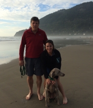
This is the sixth in a 12-part monthly series profiling scientists and technicians who provide exemplary contributions to the mission of NOAA’s Office of Response and Restoration (OR&R). This month’s profile is on Assessment and Restoration Division Northwest and Great Lakes Branch Chief Amy Merten.
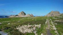
Our first day of surveying intertidal habitats on the Farallon Islands was cold and wet, with gusty winds practically blowing us over while we set out our sampling plots. The Farallones, 29 miles west of the Golden Gate Bridge in San Francisco, are a desolate cluster of seven small rocky outcrops sometimes dubbed the “Devil’s Teeth,” but other times referred to as “California’s Galapagos.” The jagged rocks are barely visible over the western horizon from the Golden Gate, but on a clear day can be seen from the more northerly Point Bonita lighthouse as gray spikes poking through an otherwise flat and expansive sea surface.
Annie Gibbs, NOAA Office of Response and Restoration
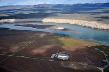
The St. Louis River/Interlake/Duluth Tar site was used for a variety of industrial purposes — including coking plants, tar and chemical companies, the production of pig iron, meat-packing, and as a rail to truck transfer point for bulk commodities — starting near the turn of the 19th century. In 1983, the St. Louis River Superfund site was added to the National Priorities List.
In November of last year, a settlement was reached between the trustees for the site and the parties responsible for the contamination. The settlement includes funds for the following restoration projects ...
By Alyssa Gray, NOAA's Office of Response and Restoration
The story behind the Sheboygan River and Harbor Superfund site began in the 1870s, when growing industrial activity along the river led to a release of contaminants, including polychlorinated biphenyls (PCBs), heavy metals, and polycyclic aromatic hydrocarbons (PAHs).
In 1979, the State of Wisconsin began advising the public against eating any resident species from the Sheboygan River, and only limited consumption of fish species from Lake Michigan, where the Sheboygan empties.
Five NOAA scientists recently led a group of more than 40 trustees in a multi-day restoration planning exercise related to the Hanford Nuclear Site. The event took place in Richland, Washington, and increased scientific convergence about habitat recovery time after restoration actions are completed in an affected area.
By Robin Garcia, NOAA Office of Response and Restoration
From Feb. 5-8, NOAA staff from throughout the country attended the annual Gulf of Mexico Oil Spill and Ecosystem Science (GoMOSES) Conference in New Orleans. Now in its sixth year, GoMOSES was developed to bring together oil spill-related experts from academia, state and federal agencies, nongovernmental organizations, and industry to share the latest oil spill and ecosystem scientific discoveries, innovations, technologies, and policies. NOAA’s Office of Response and Restoration (OR&R) has been deeply involved with the conference for many years, from serving on the executive committee and moderating sessions to presenting on research and technology.
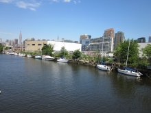
Millions of people live, work, and play in the New York-New Jersey Harbor area which supports a multi-billion dollar port, a transportation hub, and an industrial complex. These activities and its dense population are a tremendous asset to our Nation’s economy but also put immense pressures on the natural resources we depend on for our livelihood.
Fish will once again be able to swim unencumbered in New Jersey’s Millstone River as removal of the Weston Mill Dam begins.
The project is part of the settlement negotiated to compensate for potential injuries to fish and other in-river trust resources from long-term hazardous substance releases related to the nearby American Cyanamid Superfund Site in Bridgewater, New Jersey. The site was used for manufacturing of chemicals, dyes, and pharmaceuticals and for coal tar distillation from the early 1900s until 1999.
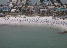
Imagine the perfect day at the beach, lying in the sand, fishing from the pier, maybe taking a boat out on the water. Then an oil spill occurs, and the beach is no longer a fun place to be.
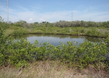
How do you return a dumpsite to a natural area with productive wetlands? With the hard work of scientists, and federal and state officials.
The Raleigh Street Dump Site is located in an industrial area of Tampa, east of McKay Bay. The low-lying land was once pocked with sinkholes and littered with battery casings, furnace slag, trash, and construction debris dumped at the site from 1977 to 1991