
 When oil spills in the ocean, NOAA uses cutting-edge mapping and spatial data tools to help respond to, clean up, and assess the impacts of pollution. These tools are utilized by the U.S. Coast Guard and other state and federal agencies to help mitigate the damage of pollution, and to guide post-spill restoration.
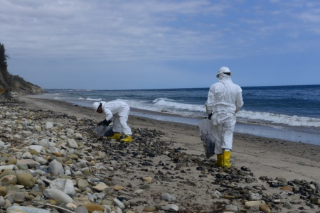
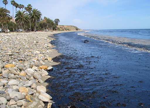
During the 2015 Refugio Beach oil spill in California, NOAA tools were used to map the spill footprint, track oiled wildlife, assess impacts, and make coordinated decisions about cleanup. By managing, mapping, and making data easily accessible, NOAA mapping tools put data in the hands of decision-makers and facilitate the use of sound science.
A new ArcGIS Story Map about the Refugio Beach oil spill puts real data from the spill response at your fingertips. Scroll through to learn about the beaches, marine mammals, and communities impacted, and how NOAA is working with partners to restore the environment.
Explore “Refugio Beach Oil Spill: Mapping NOAA’s Work from Response to Restoration” and check out three ways, also featured in the story map, that NOAA used spatial data tools to map the Refugio Beach oil spill from response to restoration below.
Mapping Oiled Shorelines
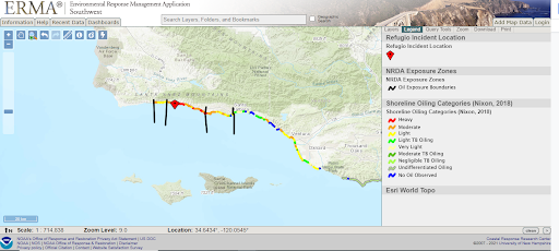
This map shows the different degrees to which shorelines were oiled, with heavier oiling resulting in more severe impacts to natural resources. The black bars show the different boundaries experts used to assess oiling in that area.
NOAA and our partners estimate that 1,500 acres of shoreline habitats were impacted by the oil. This includes sandy beaches and rocky intertidal habitats.
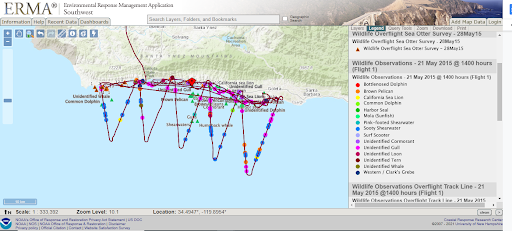
Tracking Wildlife in the Oil Spill Area
")
Scientists used helicopters and overflights to identify wildlife within the oil spill area on May 26, represented by the purple line. The dots represent different species, and the triangles represent sea otters observed on a survey on May 21.
Recovering Oiled Birds
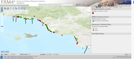
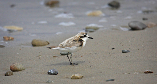
This map shows where scientists collected dead, oiled birds and live oiled birds recovered for cleaning and rehabilitation. Birds can become oiled on the shore or by diving through oiled water as they hunt for fish.
NOAA and our partners estimate that 558 birds were killed, representing 28 different species including brown pelican, common murre, Pacific loon, and scooty shearwater, among others.
Explore these interactive maps, and more, in our new story map: Refugio Beach Oil Spill: Mapping NOAA’s Work from Response to Restoration.